Crown of the Continent
Landscape Conservation Design

What is a landscape conservation design?
Landscape conservation design (LCD) is a proven landscape scale design that provides a framework to help a diversity of agencies and organizations to understand the context of their jurisdictional activities – helping all stakeholders achieve their own missions while sustaining ecosystem function at broader scales. In other words, to help land managers decide where their resources can be used most effectively.
Conservation Without Borders
Crown Managers Partnership (CMP) is leading integrative, data-informed conservation planning. The goal is to bring all of the great science, knowledge, and planning across the Crown into a landscape scale ‘design’ that considers not only wildlife and ecosystems, but cultural, social, and economic priorities as well.
CMP and a vast diversity of stakeholders in the Crown have developed outstanding conservation programs focused on specific species and ecosystems (e.g., whitebark pine, native salmonids). We are now poised to collectively integrate these programs and actions across the landscape through collaborative visioning and optimization modeling. The LCD asks the question, ‘With limited resources, where would conservation efforts be most effective?’
Over 60 management plans from across the Crown were reviewed and 15 of the most frequently mentioned species and habitats (landscape features) were selected.
The management plan for each landscape feature were reviewed to identify their largest threats.
Data was gathered to map the location of each feature and its associated threats across the landscape.
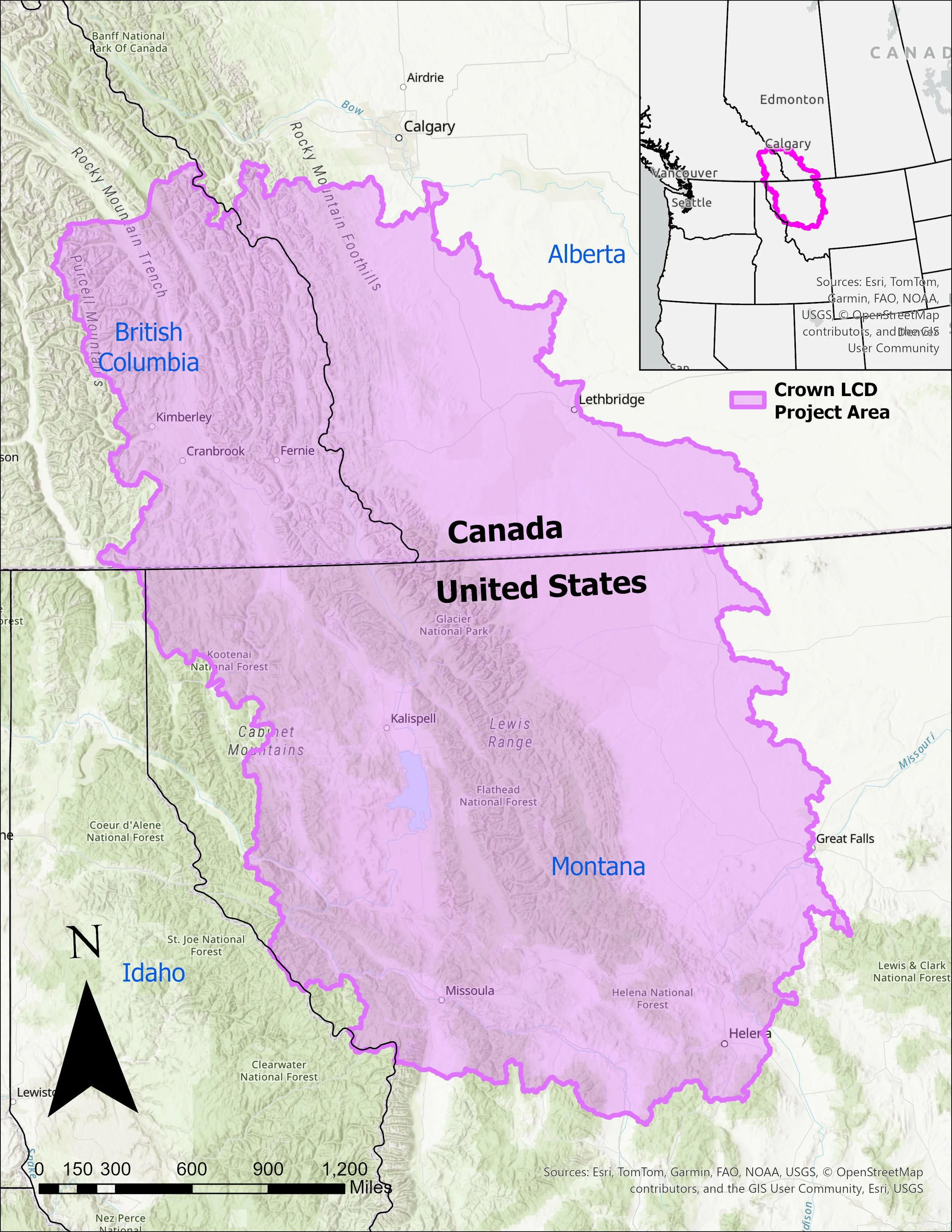
Figure 1. From mountain peaks to prairie, the Crown of the Continent LCD spans 131,508 sq km (50,775 sq mi) and straddles the United States and Canada in Alberta, British Columbia, and Montana.
The Crown LCD Progress and Accomplishments
Landscape Features

GOALS
To rely upon cutting-edge science, Indigenous knowledge, and modeling to collectively increase the resilience of waters, forests, grasslands, and creatures
To sustain healthy ecosystems, communities, and economies through working lands partnerships
To recognize and highlight the leadership, history, culture, and traditional territories of Indigenous peoples as we plan for the future
Crown LCD Phase 1

Figure 2. Mountain Pine Beetle Severity within the Crown of the Continent Ecosystems
Species
Information gathering phase.
What species and habitats are the focus of conservation efforts across the Crown of the Continent Ecosystem (CCE)?
What are the biggest threats to these species and habitats?
What data can we gather associated with these species, habitats and their threats?


Crown LCD Phase 2
Modelling and map refining phase.
How do we show where these landscape features and their threats are located on the landscape?
How do we show how the identified threats impact the health of these species and habitats?
Conceptual Models
The conceptual models were created in Phase 2 and show the pathways of how major threats impact species and habitat health. This helps highlight the degree of each threat to pinpoint where conservation efforts may best be directed. Each conceptual model reviews multiple threats and factors for each landscape feature.
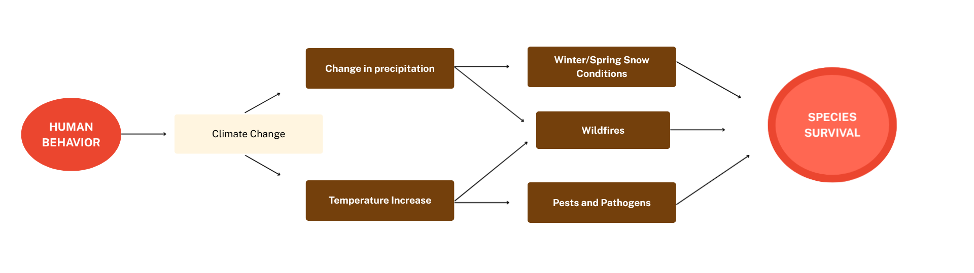
Figure 4. Example of one pathway in a conceptual model.
Referencing the model above, climate change can lead to higher temperatures and change in precipitation patterns. This leads to more frequent and more intense wildfires, more pests and pathogens and change in snow conditions. All of these factors contribute to habitat loss. This alone can decrease health and survival of a species. Other factors affecting species survival includes increased predation, hunting and trapping, increased housing infrastructure, prey density, and competition.
Explore the LCD Phase 2 Report and Executive Summary for more information on the Phase 2 process and products.



Crown LCD Phase 3
Evaluation and workshop phase.
How did we do? Review from experts and knowledge holders
How do we implement a conservation plan using the information gathered in phases 1 and 2?
As of 2026, the Crown LCD is in Phase 3. The goal of this phase is to engage land managers and Indigenous Knowledge Holders to refine and review the Phase 2 models. Ultimately, these conversations will build a multiagency strategic plan spanning the entire transboundary Crown of the Continent.
This knowledge sharing will occur during a series of workshops planned for late 2026. These workshops will engage Knowledge Holders and Western Scientists to evaluate landscape features, current and emerging threats, define what a healthy system looks like and build strategies to address the identified challenges. We have currently hosted one successful workshop (Riparian, Aquatic, and Wetlands), and have additional planned for the fall and winter of 2026.
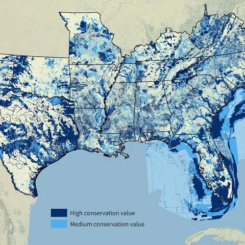
In addition to hosting workshops to share information, we are also working with the Indigenous Communities whose homelands are within the Crown of the Continent Landscape. During these sessions, we gather to listen to Knowledge Holders share the environmental, social, and economic concerns affecting their territories, and collectively brainstorm ways to respectfully include their concerns into the LCD. To date, we have held sessions with the Séliš-Ql̓ispé and Ksanka Culture Committees, and with Transboundary Blackfoot Elders and Knowledge Holders.
Summary Posters

Explore LCD projects
Workshops and Listening Sessions

Habitat & Connectivity
Spatial Models
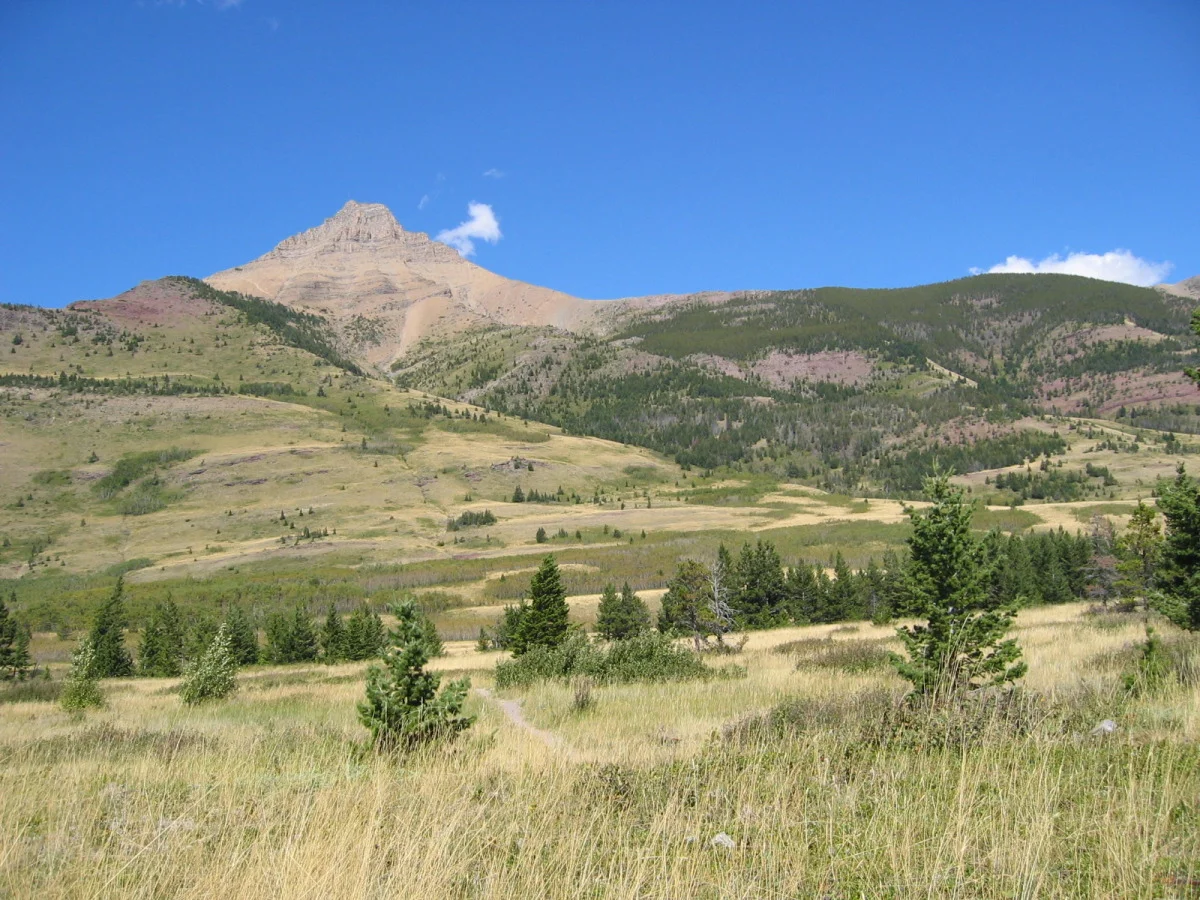
The spatial models were compiled by the LCD Technical Team and created using transboundary data, including Montana’s Natural Resource Information System and Canada’s Open Data Portal . The data sets focused on where the features are located on the landscape and where threats to these features exist on the landscape in order to focus effective management efforts.
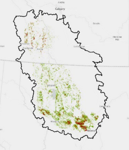
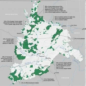
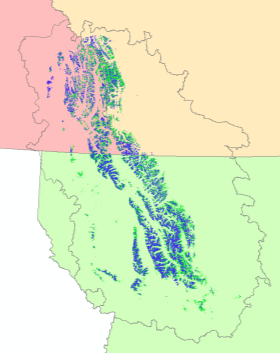
Figure 3. Example - Summary of data gathered for potential White bark Pine distribution
OUR COMMITTEES
Explore the Phase 1 report for a more detailed look at the Phase 1 process.


Leadership Team
The Leadership Team includes a diversity of social, economic, and environmental stakeholders living in the Crown of the Continent ecosystem.

Technical Team
The Technical Team is comprised of technical specialists that ensure analysts are using the best data available and vetted analytical approaches.

Analysis Team
The Analysis Team, which carries out the work plan, works with and under the guidance of the Leadership Team and in collaboration with the Technical Team.
Your participation will help shape the future Crown of the Continent. Please contact us for more information about the LCD and how to become involved.
crownmanagers@gmail.com